Con panel solar y batería en cada punto, y panel de consulta para la escuela
Caracterización botánica, vuelo, modelo entrenado para el sitio e informe técnico
Propuesta técnica y económica · CAVOUND Fairfood S.A.S.
Quito, 3 de septiembre de 2026
Señores
John Nolan · Chief Operating Officer
Stephany López Vera · Group Technical Manager
Titan Minerals Ltd. — Presente.
De nuestras consideraciones:
Tenemos el agrado de dirigirnos a ustedes con el objeto de poner a su consideración nuestra Propuesta de Servicios Profesionales, preparada sobre la base de los requerimientos identificados en la reunión de trabajo para el proyecto Dynasty, cantón Célica, provincia de Loja. La propuesta comprende dos cotizaciones independientes y consecutivas: la red de seis estaciones meteorológicas, de ejecución inmediata, y el diagnóstico y línea base del área de reforestación, previsto para el cierre de 2026. Los focos son:
El documento expone el alcance, la metodología, el equipo de trabajo, el cronograma, los honorarios y las condiciones de ejecución de cada cotización. Nuestro compromiso es entregar un trabajo verificable, sostenido en más de diez años de experiencia del equipo en monitoreo remoto e inteligencia artificial aplicada a sistemas agrícolas y ambientales, y respaldado por publicaciones indexadas.
Agradecemos la oportunidad de presentar nuestros servicios y quedamos atentos a sus observaciones. Muy atentamente,
Proyecto Dynasty · Célica, Loja
Requerimientos de Titan
Condiciones del sitio: acceso difícil, áreas dispersas —no un polígono continuo— y unos 2.000 m de desnivel entre ellas, que aportan más de una condición ecológica.
Cotización 1 · prioridad inmediata
| Concepto | Gama estándar | Mixta · recomendada | Gama reforzada |
|---|---|---|---|
| Configuración | Seis estaciones inalámbricas con consola y registro local | Una estación de referencia de grado profesional y cinco inalámbricas | Seis estaciones de grado profesional |
| Equipo de las estaciones | 3.780 | 6.540 | 20.340 |
| Mástil, energía autónoma, enlace y protección | 3.720 | 3.880 | 4.680 |
| Concentrador y enlace del sitio | 1.500 | 1.500 | 1.500 |
| Total de equipos | 9.000 | 11.920 | 26.520 |
| Instalación, integración y panel de consulta | 6.900 | 6.900 | 6.900 |
| Inversión inicial | 15.900 | 18.820 | 33.420 |
| Servicio mensual · telemetría | 220 | 220 | 220 |
| Servicio mensual · operación asistida | 340 | 340 | 340 |
Condicionantes técnicos
Método de cuantificación
Seleccione un elemento del esquema.
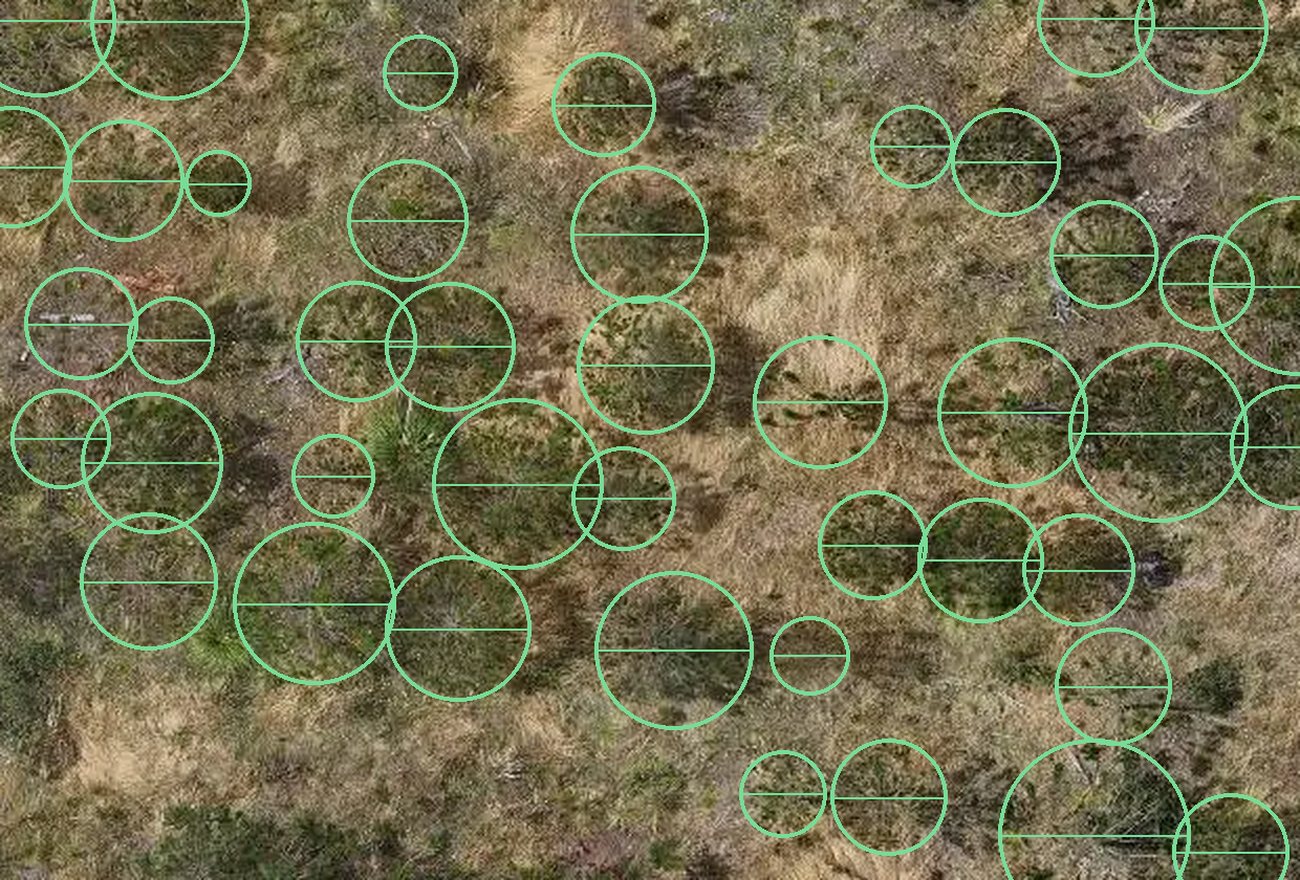
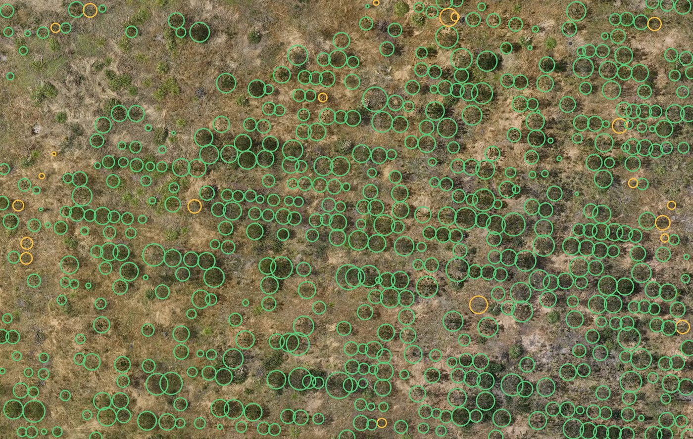
El vuelo mide altura y diámetro de copa; el eje de la izquierda es esa altura en metros. La ecuación alométrica, calibrada contra las parcelas medidas en campo, convierte esas dos medidas en biomasa, y el factor de carbono la lleva a tCO₂. La incertidumbre se declara por estrato y es mayor en regeneración, donde la copa es pequeña y la alometría menos precisa.
Diseño de muestreo
El vuelo cubre la superficie completa y entrega geometría de copa, no biomasa. Las parcelas aportan la verdad de campo que calibra esa conversión y permite declarar su error. Sin ellas el informe se limita a un conteo y un mapa; con ellas reporta una cifra con su margen.
Cuánto se mide por especie
Cada especie necesita su propia relación altura–biomasa: la de una no describe a otra. Calibrarla exige, por especie dominante, tres parcelas de 0,1 ha medidas en campo dentro del rango de tamaños y densidades en que esa especie aparece.
El vuelo cubre la superficie declarada —100 hectáreas en la Cotización 2, ampliables por hectárea—, mientras que el esfuerzo de calibración crece con el número de especies y no con las hectáreas: 10 especies dominantes suponen 30 parcelas. Las de presencia menor se registran en el listado y se les asigna la curva de la más afín, con esa asignación declarada en el informe.
La parcela se fija en 0,1 ha: por debajo domina el efecto de borde; por encima, encarece y se instalan menos.
El caso de la plantación reciente
El inventario ordinario registra individuos desde 10 cm de diámetro normal, umbral que una plantación joven no alcanza. Dentro de cada parcela se replantea un círculo concéntrico menor para los fustes delgados y el conteo se expande por la razón de superficies. La incertidumbre de ese estrato es mayor —menos individuos y alometría menos precisa en diámetros pequeños— y se reporta como tal.
Cotización 2 · ventana de fin de año
| Componente | Contenido | USD |
|---|---|---|
| Campo | Cuatro jornadas en sitio con un equipo de hasta cuatro personas —piloto, especialista forestal, especialista en desarrollo territorial y especialista en big data e IA—: vuelo multiespectral y térmico y verificación de la regeneración | 4.200 |
| Identificación botánica | Determinación de especies por el especialista forestal, colecta de ejemplares de referencia y parcelas permanentes con marcaje individual y registro dendrométrico | 3.300 |
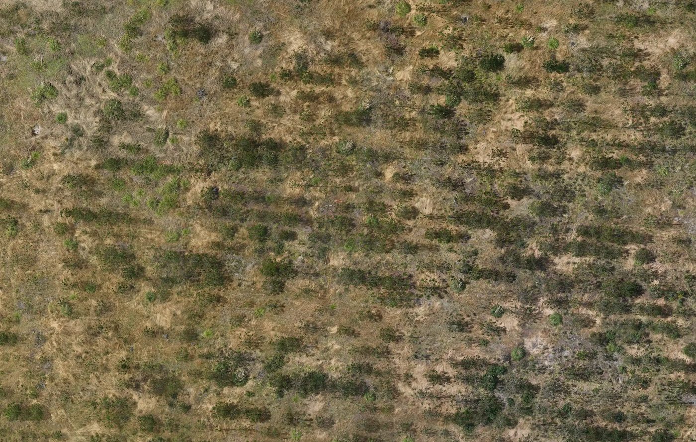
| Control geodésico y fotogrametría | Vuelo multiespectral con RTK y estación base propia en tierra —posicionamiento de 1 cm + 1 ppm en horizontal y 1,5 cm + 1 ppm en vertical—: ortomosaico a 2–5 cm/px, modelo digital de elevación del terreno, modelo de superficie y modelo de altura de dosel | 1.900 |
| Modelo de detección | Conjunto etiquetado, entrenamiento y validación cruzada contra campo. Ajustado a este sitio: un modelo entrenado sobre otra vegetación no es transferible | 2.700 |
| Selección de fuentes y serie satelital | Comparación de las herramientas disponibles —satélite público, satélite comercial y vuelo propio— para resolver cada pregunta al menor costo, y serie multitemporal 2019–2026 del área y su entorno | 1.100 |
| Análisis y estratificación | Conteo, cobertura por estrato, estratificación por altitud, índices por estrato etario y termografía | 900 |
| Informe, tablero y protocolo | Informe con método y márgenes, protocolo de re-medición, tablero con 30 días de acceso, presentación y capacitación | 900 |
| Precio cerrado del diagnóstico, hasta 100 ha | 15.000 | |
Alcance de estas cotizaciones
Entregables y criterio de aceptación
| Entregable | Criterio de aceptación |
|---|---|
| Caracterización botánica y línea base | Listado de especies con parcelas de referencia georreferenciadas |
| Modelo de detección entrenado para el sitio | Error de validación reportado sobre muestra verificada en campo |
| Estratificación por altitud y serie satelital | Estratos con superficie declarada y criterio documentado |
| Red de seis estaciones en operación | Transmisión verificada durante siete días consecutivos |
| Informe técnico y protocolo | Replicable por un tercero con el protocolo entregado |
Se dimensiona con los resultados del diagnóstico
| Seguimiento periódico de cultivos de ciclo corto: campañas recurrentes sobre las áreas productivas, con la frecuencia que defina la operación |
| Trazabilidad de cultivos: registro de lote y cadena de custodia sobre la plataforma de trazabilidad |
| Ruta hacia unidades de carbono: el diagnóstico produce la línea base y la identificación de especies, que son el insumo necesario. La evaluación de viabilidad se entrega como sección del informe, sin costo adicional |
Precisión técnica sobre las unidades de carbono: una reforestación exigida como compromiso de remediación no genera adicionalidad y no resulta acreditable bajo un estándar. La superficie plantada por encima de esa obligación sí lo sería, y el informe cuantifica ambas.
Medición · Reporte · Verificación
M · Medición
Produce: series georreferenciadas y fechadas, con su margen declarado.
R · Reporte
Produce: un documento anexable al expediente ambiental.
V · Verificación
Produce: trazabilidad auditable.
Base metodológica
Comparación y estimación
Economía del programa
La mortalidad de 25 % proviene de una síntesis de restauración en bosques tropicales asiáticos (Banin et al., 2022) y el costo por hectárea, de un caso en Morona Santiago (Universidad de Cuenca): ambos valen como orden de magnitud, no como cifras de Célica.
Plazos y condiciones
Cotización 2 · cierre de 2026. El diagnóstico y la línea base ocupan cinco semanas desde la autorización de acceso: preparación, campaña de campo, procesamiento e informe. Se ejecuta cuando la red ya haya acumulado serie propia del sitio.
Condiciones
No incluido
Siguientes pasos
| Acción | Responsable | Plazo | |
|---|---|---|---|
| 1 | Definición de los seis puntos de instalación y de sus vías de acceso | Titan Minerals | 10 días hábiles |
| 2 | Elección de gama de equipamiento y de modalidad de servicio | Titan Minerals | Con la firma |
| 3 | Autorización de acceso e inducción de seguridad | Titan Minerals | 15 días antes de la instalación |
| 4 | Coordinación con la escuela para la ubicación del panel de consulta | Titan Minerals | Antes de la instalación |
| 5 | Instalación y puesta en marcha de la red | CAVOUND Fairfood | Tres semanas desde la firma |
Las dos cotizaciones son independientes y consecutivas: la red se instala ahora y el diagnóstico se ejecuta al cierre de 2026, cuando la red ya haya acumulado serie propia. Contratadas juntas, la logística de la segunda campaña se reduce.
Equipo y antecedentes
Otros servicios del catálogo
Contacto
Interlocución
Datos de la firma
CAVOUND Fairfood S.A.S. · RUC 1793157041001
Valladolid y Francisco Salazar, Quito, Ecuador
cavound.com · smart-farming.cavound.com

Para iniciar la Cotización 1 se requiere la definición de los seis puntos de instalación, la elección de gama y modalidad de servicio, y la autorización de acceso. La conformidad puede remitirse por correo a la dirección institucional.
Technical and financial proposal · CAVOUND Fairfood S.A.S.
Quito, 3 September 2026
To:
John Nolan · Chief Operating Officer
Stephany López Vera · Group Technical Manager
Titan Minerals Ltd.
Dear Mr Nolan and Ms López:
We are pleased to submit for your consideration our Professional Services Proposal, prepared on the basis of the requirements identified at the working meeting for the Dynasty project, Célica canton, Loja province. The proposal comprises two independent and consecutive quotations: the network of six weather stations, for immediate execution, and the diagnostic and baseline of the reforestation area, scheduled for the end of 2026. The focal points are:
The document sets out the scope, methodology, working team, schedule, fees and execution conditions of each quotation. Our commitment is to deliver verifiable work, grounded in more than ten years of team experience in remote monitoring and artificial intelligence applied to agricultural and environmental systems, and supported by indexed publications.
We thank you for the opportunity to present our services and remain at your disposal for any comments. Yours sincerely,
Dynasty project · Célica, Loja
Titan requirements
Site conditions: difficult access, scattered areas —not a continuous polygon— and some 2,000 m of elevation range between them, which introduce more than one ecological condition.
Quotation 1 · immediate priority
| Item | Standard range | Mixed · recommended | Reinforced range |
|---|---|---|---|
| Configuration | Six wireless stations with console and local logging | One professional-grade reference station and five wireless stations | Six professional-grade stations |
| Station equipment | 3,780 | 6,540 | 20,340 |
| Mast, autonomous power, link and protection | 3,720 | 3,880 | 4,680 |
| Site concentrator and link | 1,500 | 1,500 | 1,500 |
| Total equipment | 9,000 | 11,920 | 26,520 |
| Installation, integration and display panel | 6,900 | 6,900 | 6,900 |
| Initial investment | 15,900 | 18,820 | 33,420 |
| Monthly service · telemetry | 220 | 220 | 220 |
| Monthly service · assisted operation | 340 | 340 | 340 |
Technical constraints
Quantification method
Select an element of the diagram.
The flight measures height and crown diameter; the axis on the left is that height in metres. The allometric equation, calibrated against the plots measured in the field, converts those two measurements into biomass, and the carbon factor takes it to tCO₂. Uncertainty is declared per stratum and is higher in regeneration, where crowns are small and allometry less precise.
Sampling design
The flight covers the full area and delivers crown geometry, not biomass. The plots provide the ground truth that calibrates that conversion and allows its error to be declared. Without them the report is limited to a count and a map; with them it reports a figure with its margin.
How much is measured per species
Each species needs its own height–biomass relationship: that of one does not describe another. Calibrating it requires, per dominant species, three 0.1 ha plots measured in the field within the range of sizes and densities in which that species occurs.
The flight covers the declared area —100 hectares in Quotation 2, extendable per hectare—, whereas the calibration effort grows with the number of species and not with the hectares: 10 dominant species imply 30 plots. Species of minor presence are recorded in the list and assigned the curve of the closest species, with that assignment declared in the report.
The plot is set at 0.1 ha: below that, the edge effect dominates; above it, cost rises and fewer are installed.
The case of the recent planting
A standard inventory records individuals from 10 cm DBH, a threshold a young plantation does not reach. Within each plot a smaller concentric circle is laid out for thin stems and the count is expanded by the ratio of areas. The uncertainty of that stratum is higher —fewer individuals and less precise allometry at small diameters— and is reported as such.
Quotation 2 · year-end window
| Component | Content | USD |
|---|---|---|
| Fieldwork | Four days on site with a team of up to four people —pilot, forestry specialist, territorial development specialist and big data and AI specialist—: multispectral and thermal flight and verification of regeneration | 4,200 |
| Botanical identification | Species determination by the forestry specialist, collection of reference specimens and permanent plots with individual tagging and dendrometric records | 3,300 |
| Geodetic control and photogrammetry | Multispectral flight with RTK and our own ground base station —positioning of 1 cm + 1 ppm horizontal and 1.5 cm + 1 ppm vertical—: orthomosaic at 2–5 cm/px, digital elevation model of the terrain, surface model and canopy height model | 1,900 |
| Detection model | Labelled dataset, training and cross-validation against field data. Fitted to this site: a model trained on other vegetation is not transferable | 2,700 |
| Source selection and satellite series | Comparison of the available tools —public satellite, commercial satellite and own flight— to answer each question at the lowest cost, and 2019–2026 multitemporal series of the area and its surroundings | 1,100 |
| Analysis and stratification | Count, cover per stratum, stratification by altitude, indices per age stratum and thermography | 900 |
| Report, dashboard and protocol | Report with method and margins, re-measurement protocol, dashboard with 30 days of access, presentation and training | 900 |
| Fixed price of the diagnostic, up to 100 ha | 15,000 | |
Scope of these quotations
Deliverables and acceptance criteria
| Deliverable | Acceptance criterion |
|---|---|
| Botanical characterisation and baseline | Species list with georeferenced reference plots |
| Site-trained detection model | Validation error reported on a field-verified sample |
| Stratification by altitude and satellite series | Strata with declared area and documented criterion |
| Network of six stations in operation | Transmission verified over seven consecutive days |
| Technical report and protocol | Replicable by a third party with the delivered protocol |
Sized from the results of the diagnostic
| Periodic monitoring of short-cycle crops: recurring campaigns over the productive areas, at the frequency defined by the operation |
| Crop traceability: batch records and chain of custody on the traceability platform |
| Pathway to carbon units: the diagnostic produces the baseline and the species identification, which are the necessary input. The feasibility assessment is delivered as a section of the report, at no additional cost |
Technical clarification on carbon units: reforestation required as a remediation commitment does not generate additionality and is not creditable under a standard. Area planted beyond that obligation would be, and the report quantifies both.
Measurement · Reporting · Verification
M · Measurement
Produces: georeferenced, dated series, with their declared margin.
R · Reporting
Produces: a document that can be annexed to the environmental file.
V · Verification
Produces: auditable traceability.
Methodological basis
Comparison and estimation
Programme economics
The 25% mortality comes from a synthesis of restoration in Asian tropical forests (Banin et al., 2022) and the cost per hectare from a case in Morona Santiago (Universidad de Cuenca): both hold as orders of magnitude, not as figures for Célica.
Schedule and conditions
Quotation 2 · end of 2026. The diagnostic and baseline take five weeks from access authorisation: preparation, field campaign, processing and report. It is executed once the network has accumulated its own series for the site.
Conditions
Not included
Next steps
| Action | Responsible | Deadline | |
|---|---|---|---|
| 1 | Definition of the six installation points and their access routes | Titan Minerals | 10 working days |
| 2 | Choice of equipment range and service mode | Titan Minerals | On signature |
| 3 | Access authorisation and safety induction | Titan Minerals | 15 days before installation |
| 4 | Coordination with the school on the location of the display panel | Titan Minerals | Before installation |
| 5 | Installation and commissioning of the network | CAVOUND Fairfood | Three weeks from signature |
The two quotations are independent and consecutive: the network is installed now and the diagnostic is executed at the end of 2026, once the network has accumulated its own series. Contracted together, the logistics of the second campaign are reduced.
Team and track record
Other services in the catalogue
Contact
Points of contact
Company details
CAVOUND Fairfood S.A.S. · RUC 1793157041001
Valladolid y Francisco Salazar, Quito, Ecuador
cavound.com · smart-farming.cavound.com
To start Quotation 1, the six installation points must be defined, the equipment range and service mode chosen, and access authorised. Acceptance may be sent by email to the institutional address.
← → o espacio para navegar · L para cambiar de idioma← → or space to navigate · L to switch language